blah blah blah
Emerald Bluff
Length: 7.3 miles out-and-backDifficulty (click for info): Very Hard
Elevation Gain: 2530 feet (+50 feet on return)
Rating (click for info): 8/10
Elevation: 4023'
Prominence: 15'
Driving Directions:
Trailhead and parking area are on Rt. 2 in Randolph, NH. Park in the large parking area for Castle Trail, on the southern side of the road, in front of an open field. This is 4.2 miles east of the junction with Rt. 115 and 8.3 miles of Rt. 16 in Gorham. Click here for a Google map.
About the Hike:
The Presidential Range is famous for its glacial ravines. With intensely steep terrain, tortured rock slides, craggy cliffs, and abundant waterfalls, they provide some of the most challenging and exciting routes to the northern peaks. There are a few options for experiencing the grandeur of the ravines without committing to the full trip up the headwall of one of them, but none captures their profound beauty quite like Emerald Bluff. Located partway up Mt. Adams's Israel Ridge at a respectable elevation over 4000 feet, the craggy perch offers spectacular views over the diverse terrain of Castle Ravine, from the rock slides to the castle formations. Make no mistake, it's still quite an adventure to get to this point, with steep and rocky terrain and even a few ladders. You'll also have to cross the Israel River a couple times, something you want to avoid if water is high. Along the way, you'll pass by First and Second Cascades. The two cascades tumble a combined 250+ feet on their way down extensive open ledges with views out to the north.
Starting out from the Castle Ravine Trailhead, with views of the high peaks over the field, head down the rail trail to the right past the gate for less than 0.1 miles and turn left into the woods at a sign for Castle Trail. The trail crosses a pipeline corridor, then runs through the woods beside the field (and house). At 0.3 miles total, it crosses through a powerline cut. It re-enters the woods and arrives beside the Israel River. Follow it upstream for a bit, then cross to the other side. The river is shallow and stony here, and the crossing can be very difficult if the water is high. The trail heads uphill on the other side, following the river closely for a bit. The terrain is easy and the walk uneventful for the next 0.9 miles. At the junction, bear left onto Israel Ridge Path as Castle Trail goes straight. It curves around the hillside and descends back toward the river, and after 0.1 miles, crosses it. Once again, stepping stones are small and this crossing can be difficult if the water is not low. The trail stays close beside the river and climbs over some rocky and washed out areas right along the bank. The river is wild and rough as it bubbles through the boulders. After 0.3 miles, arrive at a junction and bear left again, away from the stream. You're staying on Israel Ridge Path as Castle Ravine Trail stays alongside the river. The trail climbs further up the hillside, starting out in a wide open wood. Then, the slope steepens as you enter Cascade Ravine, and the narrow trail angles up across the hill. It becomes rougher and rockier, but doesn't climb too steeply overall.
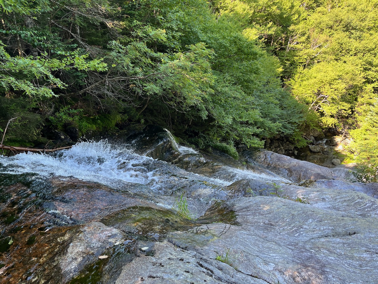
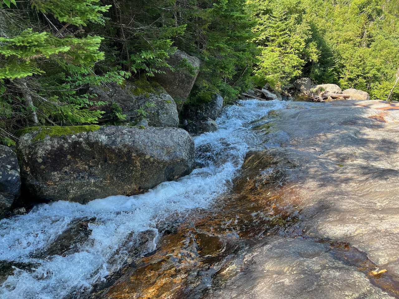
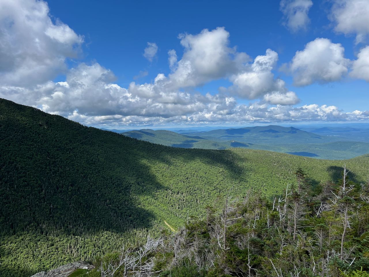
After 0.8 miles, you'll reach a junction with The Link. It merges from the left in the middle of a rock slab that can be slippery. Just a bit further, the trails split again. Bear right onto The Link as it descends toward Cascade Brook, a tributary of the Israel River. This will take you to where the trail crosses this brook, at the top of First Cascade. The brook flows down from the shelter of the tight spruce forest and tumbles down the wide, smooth ledges, ending with a final straight drop. It's quite an impressive waterfall, although it's difficult to access the base of the falls to see the whole drop clearly. Backtrack on The Link to the junction and turn right to continue on Israel Ridge Path. Pass the junction with Cabin-Cascades Trail on the left, and continue up through the rough terrain beside the cascading stream for 0.1 miles. After climbing up a couple small ladders, an opening appears on the right side of the trail, where you can walk out to the much more expansive open ledges of Second Cascade. The brook slides down the far side of the rock; it is a much lesser angle than First Cascade, but larger overall. The pitch is shallow enough that you can walk up and down the ledge alongside the cascades. From higher up on the ledges, there is a nice view out to the northwest. Nearby Mt. Bowman takes up most of the frame, but you can also see out toward Vermont, with Burke and Umpire Mountains appearing prominently.
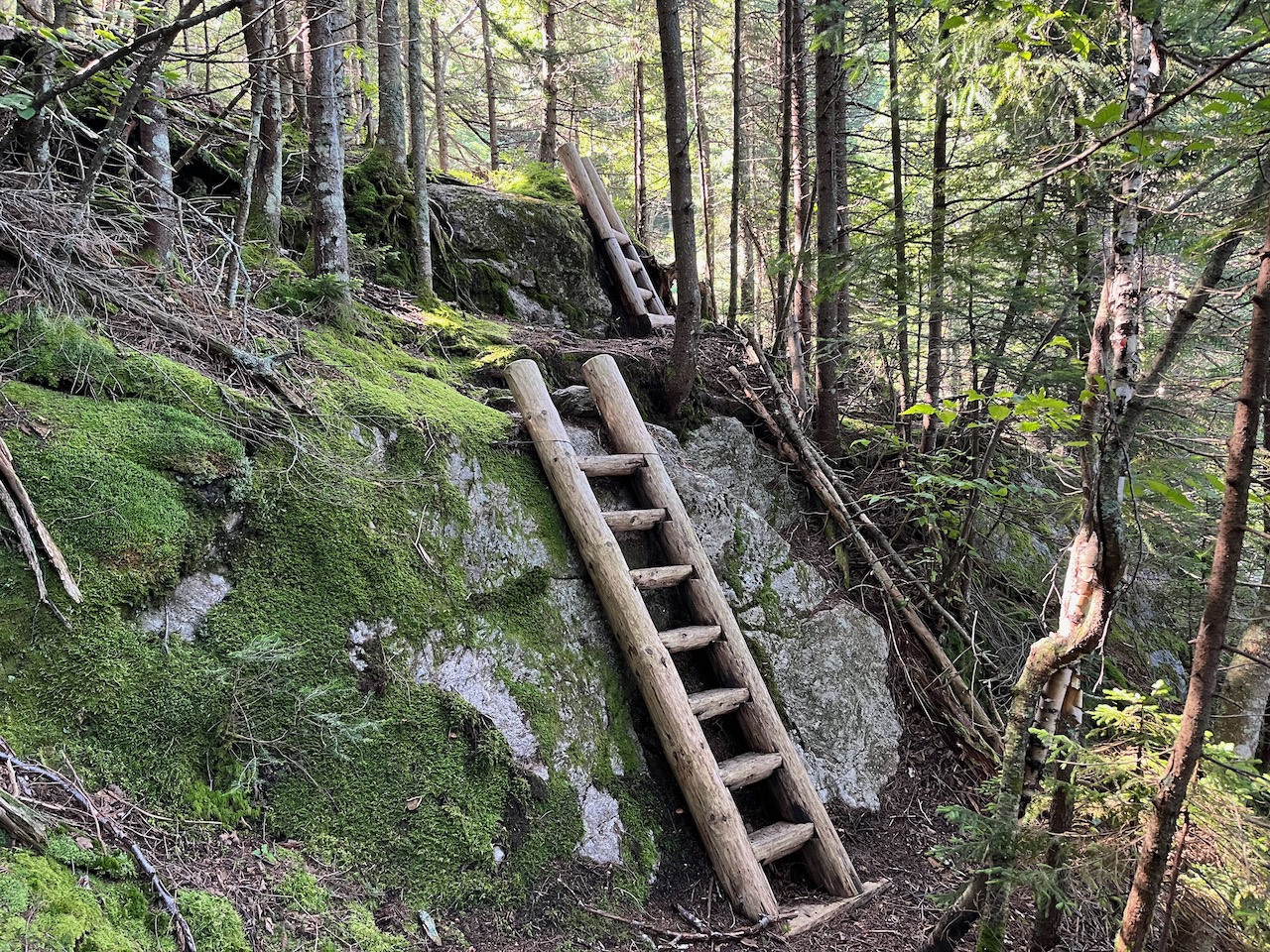
The trail continues right beside the ledges and swings around to the top of the cascades, where the drop begins out from a pile of boulders. It crosses the brook, heads slightly downhill, then swings around to start climbing again. It quickly ramps up in grade and ascends very steeply out of the ravine. In two places the trail climbs up over longer ladders/wooden steps to surmount steep pitches. After about 0.2 miles of relentless steep climbing, the trail begins to moderate as it settles into high-elevation spruce forest with abundant moss. It runs more along the side of Israel Ridge, with occasional glimpses through the trees at the ravine walls. The trail climbs steadily up the side of the ridge through a lush and dense forest for about a half a mile to reach a junction with Emerald Trail.
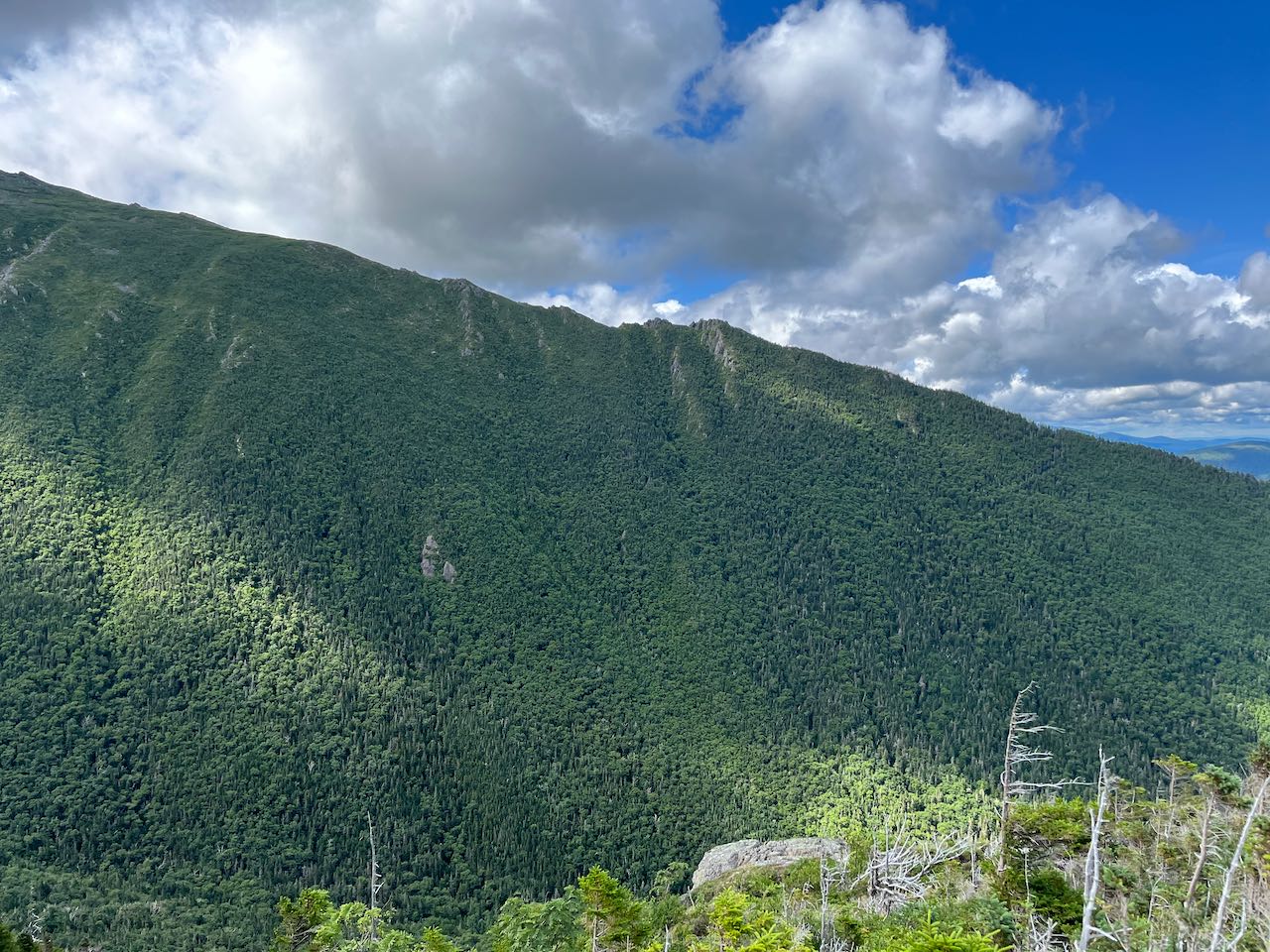
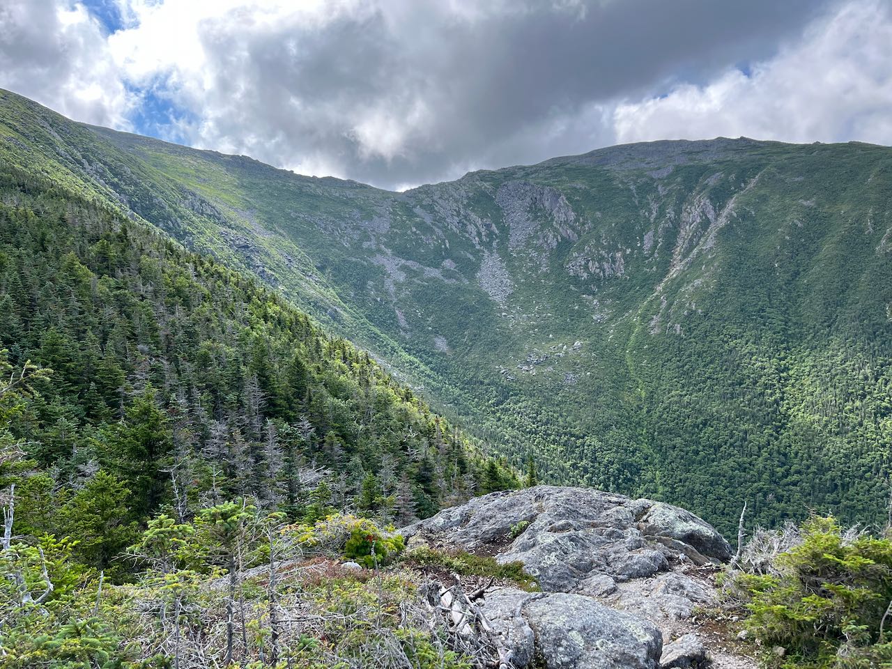
Turn right onto this trail, almost at your destination, and enjoy a reprieve from the climbing. The trail leads flat across the mountainside for 0.1 miles and reaches another junction. Bear right on a short spur trail that leads up a rocky knoll and emerges on the open, airy ledges of Emerald Bluff among the krummholz. The first thing that greets you is the spectacular view across Castle Ravine to the Castellated Ridge. The medieval-looking rock formations for which the ridge is named stick out like sharp teeth from the green canopy of the ridge. You can see the whole sweep of the giant bowl of the ravine, with huge cliffs and slides of talus draping down into it. Straight uphill, the summits of the peaks are hidden behind the bulk of the ridges all around. Looking down and out the ravine, the distant view takes you to the outlines of the Vermont peaks first seen from the cascades. Closer up you have Cherry Mountain in the center, and Mts. Dartmouth and Deception to the left, with the little nubble of Currier Mountain in front of them. It is a truly unique view that reveals the most breathtakingly rugged sights in the Presidential Range.
Printable directions page